
The Challenge
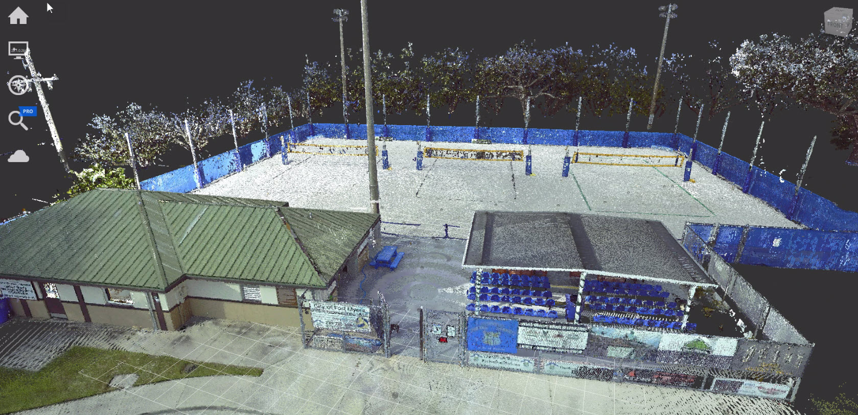
AsBuilt was commissioned to perform comprehensive 3D laser scanning services for a city-owned sports complex. The facility was frequently overbooked and operating beyond intended capacity, prompting the city to evaluate expansion and improvement options.
However, the city had no accurate architectural drawings, site plans, or documentation of existing conditions. This lack of reliable data limited the ability to:
- Evaluate expansion feasibility
- Plan facility upgrades
- Analyze building and site constraints
- Coordinate with contractors and engineers
- Support insurance and asset documentation
Without verified as-built information, design planning would require repeated site visits and manual measurements, increasing time and cost.
The Solution
Full Interior & Exterior Laser Scanning
AsBuilt conducted a high-resolution terrestrial laser scan (LiDAR) of the entire sports complex, capturing:
- Building interiors and exterior façades
- Athletic courts and common areas
- Structural components
- Light poles, site fixtures, and utilities
- Property boundaries and surrounding site features
The scan data was processed into a registered point cloud, providing a complete digital representation of the facility and site.
Digital Documentation & Planning Support
The point cloud enabled precise documentation of:
- Exact building dimensions and layouts
- Spatial relationships between structures
- Pole, boundary, and asset locations
- Complicated geometries and elevation changes
Dimensions could be extracted directly from the digital model, eliminating the need for repeat site visits.
Additionally, the dataset was tied to GPS coordinates and the city grid, ensuring accurate geospatial positioning of all assets.
Quick Facts
Shared Access
City managers, contractors, architects, and engineers accessed the facility remotely through online visualization tools, enabling collaborative planning and design evaluation.
Time Savings
After scanning, stakeholders no longer needed to travel on-site to verify measurements or explore design options.
Comprehensive Facility Documentation
The sports complex was digitally archived. In the event of storm damage, fire, or other disaster, the facility’s pre-loss condition was fully documented for insurance and recovery planning.
GPS Integration
The point cloud was georeferenced to the city grid, providing exact asset location data for planning and infrastructure coordination.
Deliverables
- Registered point cloud
- Online visualization platform access
- Ongoing visualization support