
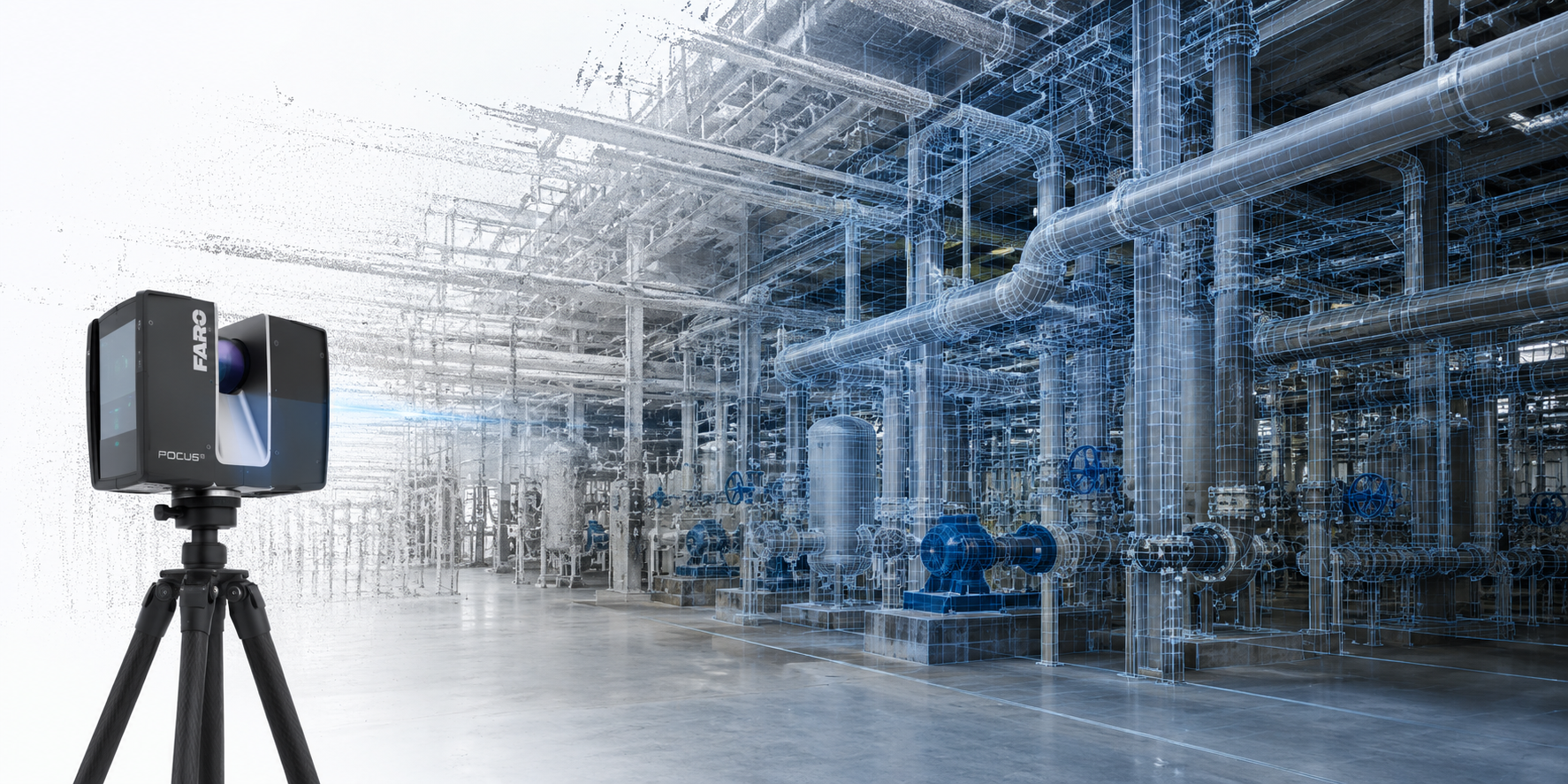
Capture existing conditions with 3D laser scanning
High-accuracy 3D laser scanning services that document facilities, structures, equipment, and site conditions with reliable point cloud data for modeling, planning, and construction.
What 3D laser scanning provides
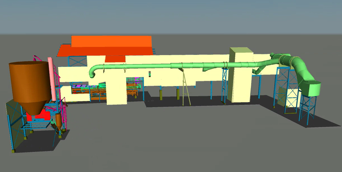
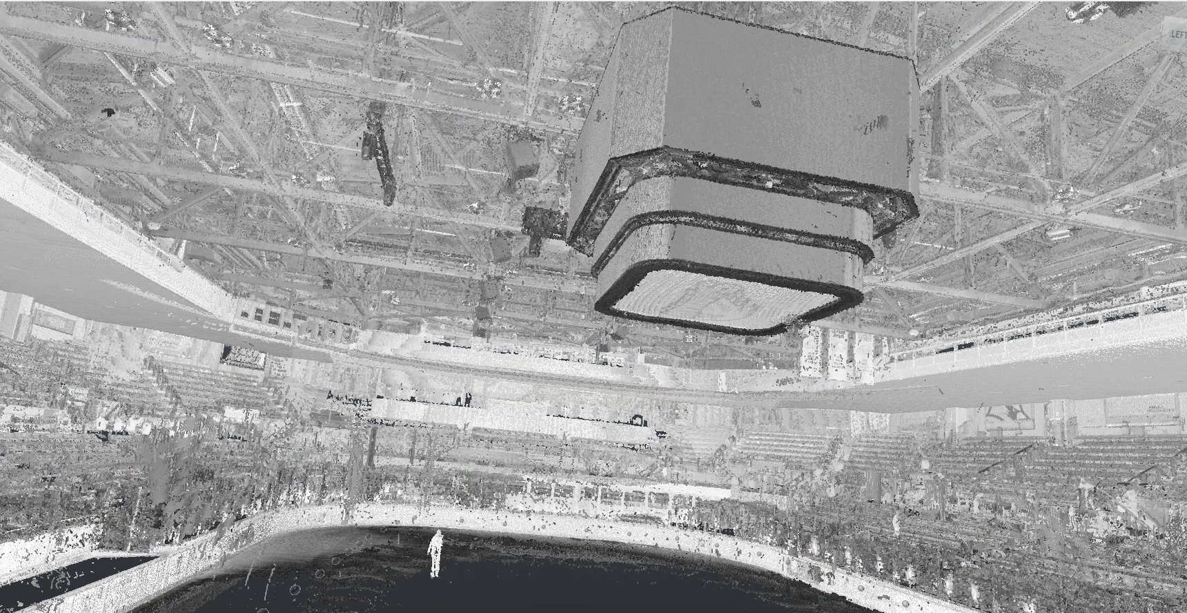
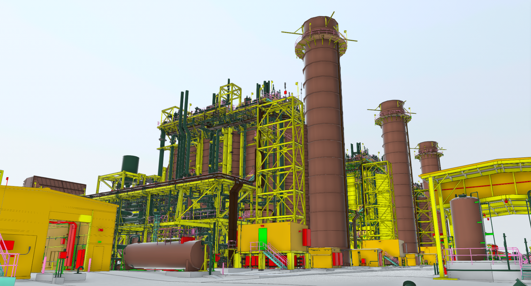
3D laser scanning captures millions of precise measurements to create a digital record of existing conditions. The resulting point cloud gives project teams accurate spatial data for modeling, coordination, planning, and documentation.
When 3D laser scanning delivers the most value
Use 3D laser scanning when project decisions depend on accurate site information. It is especially valuable when drawings are outdated, spaces are complex, or field verification is needed before design, fabrication, or construction.
Documenting existing conditions before design or construction
Supporting retrofit, expansion, and facility modification projects
Creating point cloud data for CAD, BIM, and scan-to-BIM workflows
Verifying equipment, structural, piping, and MEP conditions
Capturing closeout documentation and long-term facility records
Reducing risk from outdated drawings or incomplete site information
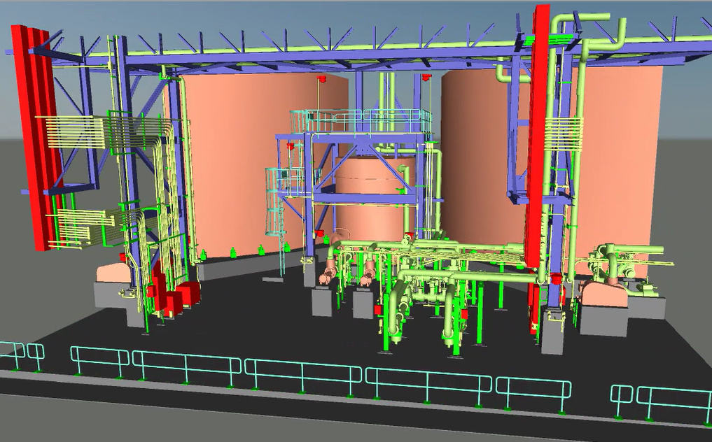
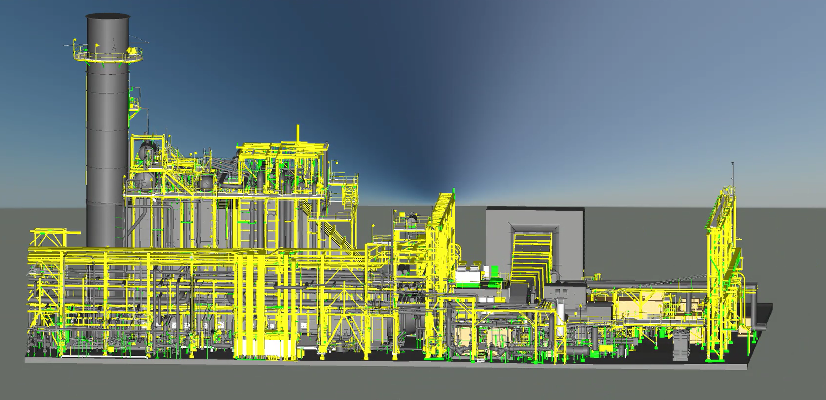

Deliverables from 3D laser scanning
Each scanning project produces documented, verified outputs ready for downstream use.
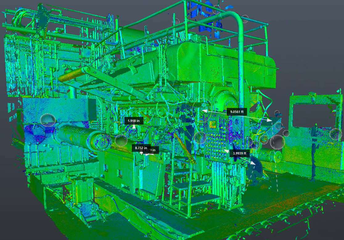
Registered point cloud data
High-resolution, georeferenced point cloud data captured on site and delivered in standard formats compatible with common engineering and BIM tools.
Scan control and registration documentation
Supporting documentation demonstrating scan alignment, control, and consistency across the captured environment.
Industry-standard export formats
Deliverables provided in standard file formats such as E57, RCP, LAS, and PTX for direct use in design, modeling, and analysis tools.
Verified accuracy and QA review
Verification of scan data against defined project requirements to ensure measurement integrity and reliability for intended use.
From site to deliverable—executed in three controlled phases
We move methodically from discovery through field capture to validated deliverables. Each phase builds on the last to ensure accuracy, completeness, and usability.
Scope and site preparation
We review site access, safety requirements, and accuracy needs, establish control points, and plan scanner placement to ensure full coverage before field work begins.
Capture and registration
Our team deploys scanners at strategic locations, captures millions of spatial measurements, and registers all scans into a single, unified coordinate system.
Delivery and validation
We process, validate, and quality-check the data against project requirements, delivering registered point clouds and documentation in standard formats ready for downstream use.
Outcomes that impact real projects
Accurate existing-condition data changes how teams plan, coordinate, and execute—reducing uncertainty across the project lifecycle.
Speed to insight
Field capture and processing happen in days, not weeks—so teams can validate conditions and make decisions earlier in the project lifecycle.
Designs aligned to reality
Millimeter-level accuracy and unified scan data ensure designs align with real-world conditions—reducing assumptions and downstream rework.
Complex retrofit support
Capture complex, constrained, or active spaces where traditional surveys fall short—supporting retrofits, expansions, and modifications with confidence.
Defensible long-term records
Accurate, validated scan data remains usable long after project close—supporting future planning and operational decisions.
Start with accurate data you can trust
Talk with our team about your facility, scope, and objectives to determine the right capture, modeling, and analysis approach.